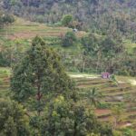
Location and The Balinese believe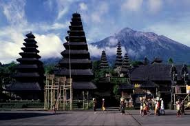
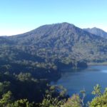
Mount Agung is a strato-type volcano with the height of 3,142 above sea level.Located at KarangAsem Regency, sub distric of Rendang ,East part of Bali Island. it has a very large and very deep crater that sometimes bring out of smoke and moisture. This mountain looks perfectly sharp,this mount elongated and ends in a circular crater and wide. it is the highest and the most sacred mountain for the Balinese. on the foot of the mt agung also found the Hindu biggest Temple called the Besakih Temple(the mother Hindu Temple), where they believes as the abode of the gods and the ancestors before they could reincarnate to the earth.
The Eruption History
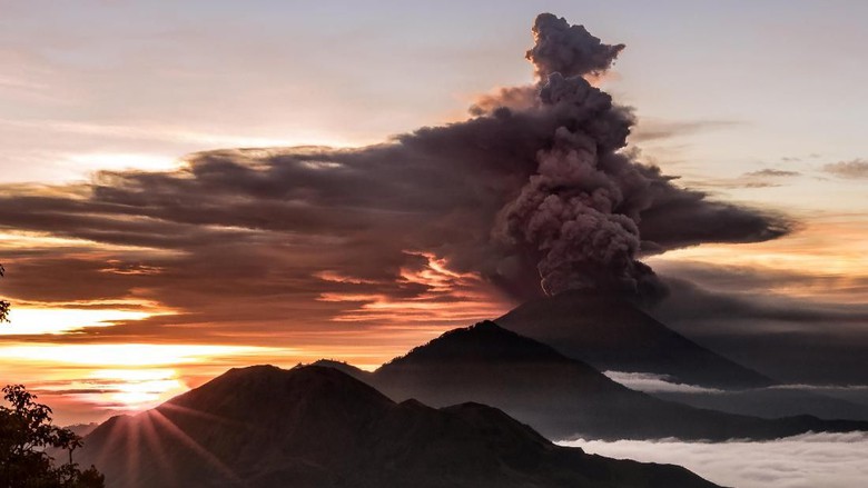
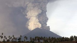 According to the Record of Mt Agung eruption is only known as much as four times, in the year of 1800,1821,1843 and the last eruption was in 1963 where killed almost 1100 peoples more and destroyed a lots of villages surrounding the area. After Since the last 53 years ,it has not shown really significant activities, the mount Agung has begun its activities since the last September 2017.and the eruption has occurred on Saturday, November 25,2017, which is began with freatic type of explosion by thrown out a huge number of high pressure gases and ashes from the beneath of the volcano to the air at the altitude of 1500metres till 3000 meters over the Mt Agung Crater. and the eruption is still on going with the chancing type of the eruption from phreatic to magmatic which can caused more bigger explosion possibility.
“The eruption rate of Mount Agung began to increase from phreatic to magmatic on November 25th at 23.00 pm, and to this day the magmatic eruption continues to occur. In fact, last night a continuous effusive eruption took place, accompanied by a banging sound and this indicated a greater potential for eruptions, possibly in the future. Considering these conditions, PVMBG( the Center for volcanology and Geological Dissaster Mitigation) increased the volcanic activity status of Gunung Agung from Siaga (level III) to Awas Level IV as of November 27, 2017, at 06.00 Wita, “said Head of Mitigation Division of Volcanology and Geological Hazard Mitigation I Gede Suantika on Monday (27 / 11/2017)”.
The impact of the eruption on the tourism in Bali
As known, the Bali government has started to make a lots of preparations to against the threat of Mt Agung eruption in Bali. It follows the latest report of the Meteorology and Geophysics Agency which provides the status all time related to the condition of Mount Agung. The proof, tens to hundreds of thousands of residents have been evacuated and took mitigation steps to preparing the measures impact of the eruption.
But the Bali Government has to closed the international Bali airport as well on Monday,November 27,2017 for the next 24 hours due to the volcanic dust which has closed the air space at the airport up to two level. several flight departure are suspended and so does flight arrival that supposed to land in Bali airport were cancelled.
Mt agung is located at the eastern part of Bali ,some part of Bali island are still safe to stay and to visit such as south bali area,middle bali ,west and north bali area. it has still an option to come to Bali through the other airport in Java even Bali airport is closed.. Then take a train or local taxi to Ketapang harbour to Gilimanuk harbour which is connected Bali and Jawa Island.
Eventually we can just pray and wished that our beautiful Bali can passed this natural catastrophes disaster as soon as possible. So we can get back to our normal life and doing our activities as usually.
A very big thanks to every Balinese people,Bali provincial government,PVMBG,Bali international airport and all parties who concerned very much and has always working together (gotong royong) to prevent and protect all aspects due to this Mt Agung eruption.May God Bless Us Always !
Best wishes
bli gojink bali
www.bli gojink bali.com